Geotechnical investigation in Chandler, Arizona, encompasses a suite of subsurface exploration techniques designed to characterize soil, rock, and groundwater conditions prior to construction. This category is fundamental to safe and economical design, as it provides the data necessary to assess bearing capacity, settlement potential, liquefaction risk, and excavation stability. In a rapidly expanding city like Chandler, where residential subdivisions, commercial complexes, and public infrastructure projects are continuously under development, understanding the heterogeneous valley-fill deposits is not just a regulatory requirement but a practical necessity to avoid structural distress and costly remedial measures.
The local geology of Chandler is dominated by the Basin and Range physiographic province, with subsurface conditions primarily consisting of Quaternary alluvial deposits derived from the nearby San Tan and South Mountains. These sediments include interbedded layers of sandy silts, clayey sands, and gravels, often with significant variability in density and cementation over short lateral and vertical distances. Additionally, the presence of caliche, or pedogenic calcium carbonate, is common and can present drilling challenges while also influencing foundation design due to its variable hardness and dissolution potential. Groundwater depth fluctuates but is generally encountered at moderate depths, requiring careful consideration for deep excavations or basement construction.
In the United States, and specifically within Arizona, geotechnical investigations are governed by a combination of national standards and local jurisdictional requirements. The International Building Code, as adopted by the City of Chandler, mandates that soil investigations be conducted by a registered design professional and that reports include adequate data to substantiate foundation and earthwork recommendations. Testing procedures must comply with ASTM International standards, such as ASTM D1586 for the Standard Penetration Test (SPT) and ASTM D5778 for the Cone Penetration Test (CPT). Furthermore, the Arizona Registrar of Contractors and the Arizona Board of Technical Registration enforce licensing requirements for firms and engineers performing these studies, ensuring accountability and technical competence.
The scope of an investigation is tailored to the project type, ranging from small-scale single-family home additions to large industrial warehouses and municipal utility corridors. A simple exploratory test pit excavation might suffice for a shallow footing evaluation in a lightly loaded structure, allowing direct visual inspection of soil stratigraphy and sampling. Conversely, a multi-story building or a bridge abutment will demand a rigorous combination of CPT soundings for continuous profiling of tip resistance and sleeve friction, alongside mud-rotary borings with SPT sampling to obtain disturbed and undisturbed specimens for laboratory strength and consolidation testing. Each method contributes a unique dataset that, when integrated, forms a comprehensive geotechnical model.
Questions and answers
What is the purpose of a geotechnical investigation in Chandler?
A geotechnical investigation identifies subsurface soil, rock, and groundwater conditions to evaluate a site's suitability for construction. It determines bearing capacity, settlement potential, and excavation stability, enabling engineers to design safe foundations and earthworks. In Chandler, this process is essential due to variable alluvial deposits and is required by the City's adopted building code before obtaining construction permits.
When is a geotechnical investigation required by the City of Chandler?
The City of Chandler, through the International Building Code, requires a geotechnical investigation for all new commercial, industrial, and multi-family residential projects. Single-family homes may have limited requirements, but any structure needing a building permit typically demands some level of subsurface evaluation. The report must be prepared by an Arizona-registered engineer to address specific site hazards and foundation recommendations.
How deep do exploratory borings typically go during an investigation?
Boring depth depends on the proposed structure's loads and the geological context. For standard shallow foundations in Chandler, borings often extend 20 to 30 feet below grade, or deeper if compressible layers are suspected. For deep foundations like driven piles or drilled shafts, investigations may reach 60 to 100 feet to fully characterize the bearing strata and assess downdrag or lateral resistance.
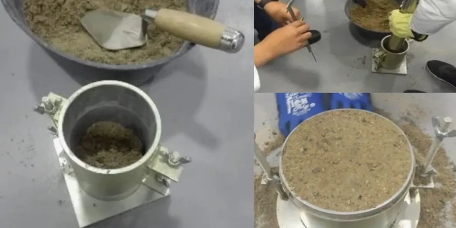
What are the main differences between SPT and CPT testing methods?
The Standard Penetration Test (SPT) involves driving a split-spoon sampler into the soil at intervals within a borehole, providing a disturbed sample and an N-value for empirical correlations. The Cone Penetration Test (CPT) pushes an instrumented cone continuously from the surface, measuring tip resistance and sleeve friction without sampling, offering a near-continuous profile of soil behavior type and stratigraphy with greater speed and resolution.